Groveway Community Park
(also called Waller Park)
160 Dobbs Drive
Roswell, Georgia 30075
field status: (770) 641-3836
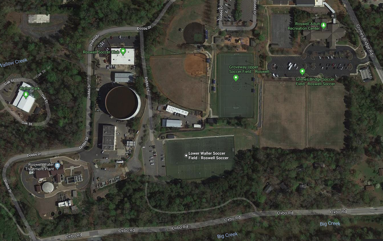
Groveway Community Park (also called Waller Park) is neighbor to Roswell’s Grimes Bridge Park. There are two artificial turf fields, named Upper and Lower. The park has restroom facilities.
Directions from Metro North Park
Driving time is approximately 20 minutes. If you live close to Shallowford Road, check the UQP directions.
- Turn left onto Paper Mill Road and go 0.2 miles to Johnson Ferry Road.
- Turn left onto Johnson Ferry Road and go 1.2 miles to the intersection with Lower Roswell Road.
- Turn right onto Lower Roswell Road and go 2.9 miles to the intersection with Willeo Road.
- Turn right onto Willeo Road and go 1.8 miles to the intersection with Marietta Highway (also known as Hwy-120 and Upper Roswell Road).
- Turn right onto Hwy-120 and go 0.7 miles to a 3-way intersection with Hwy-9 and Atlanta Street.
 Turn left onto Hwy-9 / Atlanta Street and go 0.3 miles to Oxbo Road.
- Turn right onto Oxbo and go 0.6 miles to Dobbs Drive.
- Turn left onto Dobbs Drive and go 0.3 miles to the intersection with Dobbs Court. You’ll pass the Roswell water treatment plant during this stretch. You can click the satellite map on the right to get a better view of the area.
- Upper field: Continue another 0.1 miles on Dobbs Drive to the upper parking lot.
- Lower field: Turn right onto Dobbs Court and go 0.1 miles to the lower parking lot.
Directions from United Quest Park
Driving time is approximately 25 minutes.
- Turn left onto Hawkins Store Road and continue to Canton Road.
- Turn left (north) onto Canton Road and go 0.7 miles to Shallowford Road.
- Turn right at a traffic light onto Shallowford Road and go 10.2 miles to the intersection with Hwy-9 / Atlanta Street / Canton Street. During this stretch, Shallowford becomes Pine Grove Road and then Magnolia Street.
- Turn right onto Atlanta Street and go 0.4 miles to Oxbo Road.
- Turn left onto Oxbo and go 0.6 miles to Dobbs Drive.
- Turn left onto Dobbs Drive and go 0.3 miles to the intersection with Dobbs Court. You’ll pass the Roswell water treatment plant during this stretch. You can click the satellite map above to get a better view of the area.
- Upper field: Continue another 0.1 miles on Dobbs Drive to the upper parking lot.
- Lower field: Turn right onto Dobbs Court and go 0.1 miles to the lower parking lot.