King’s Ridge Christian School
2765 Bethany Bend
Alpharetta, GA 30004
field status: use the host club’s field status site (NTH activities: https://www.nasatophat.com/fields)
field layout: TBD
King’s Ridge is new to the soccer circuit as of 2018. Our maps editor has not yet been there to verify driving directions or facilities.
Directions from Metro North Park:
Driving time is about 30 minutes, distance is about 20 miles. Driving directions:
- Turn left onto Paper Mill Road, go a quarter of a mile to the intersection of Paper Mill and Johnson Ferry Road.
- Turn right onto Johnson Ferry Road and go 1.6 miles to Abernathy Road.
- Turn left onto Abernathy Road and go just under 2 miles to the GA-400 interchange.
- Turn left to take GA Highway 400 North (US-19).
- Stay on GA-400 North for 12.0 miles until exit #11: Windward Parkway (Alpharetta).
- Turn left onto Windward Parkway and go 3.0 miles. The road name changes to Cogburn Road midway during this stretch.
- Turn left onto Bethany Bend and go 0.3 miles.
- Turn left into King’s Ridge Christian School.
Directions from United Quest Park:
Driving time is about 40 minutes, distance is about 18 miles. Driving directions:
- Turn left onto Hawkins Store Road and go to Canton Road.
- Turn left (north) at a traffic light onto Canton Road and go 0.7 miles to Shallowford Road.
- Turn right at a traffic light onto Shallowford and go 3.8 miles to a large intersection with Sandy Plains Road.
- Turn left at a traffic light onto Sandy Plains and go 3.1 miles until it ends at Highway 92, also called Woodstock Road.
- Turn right at a traffic light onto Highway 92 (Woodstock Road) and go 1.7 miles until you reach Hardscrabble Road.
- Turn left at a traffic light onto Hardscrabble Road and go 2.3 miles. Hardscrabble merges with Crabapple Road during this stretch.
- Stay on Crabapple for an additional 2.7 miles, crossing GA-140 / Arnold Mill Road / Houze Road. The road name will change to Mayfield Road during this stretch.
- Turn left onto Bethany Road and go 2.0 miles until you reach Bethany Way.
- Turn right onto Bethany Way and go 0.7 miles until you reach Hopewell Road.
- Turn right onto Hopewell Road and go 0.1 miles to Bethany Bend.
- Turn left onto Bethany Bend and go 0.8 miles.
- Turn right into King’s Ridge Christian School.
Field layout:
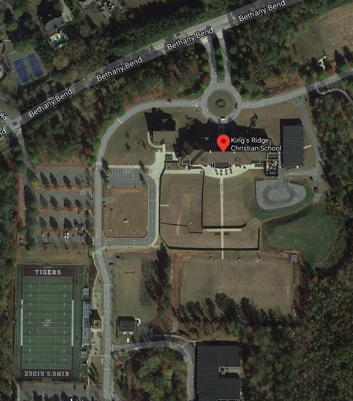
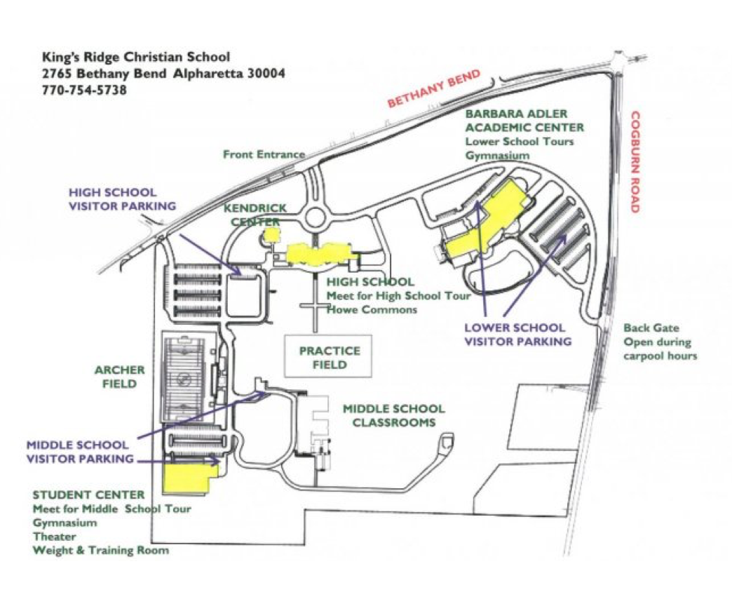 We’re not yet sure which fields are which. Here’s a campus map (left) and a recent overhead view of the campus (right).